06 Nights / 07 Days
Hard Trek
14,750 ft
May to June & Sept to Oct
Uttarakhand
Badrinath
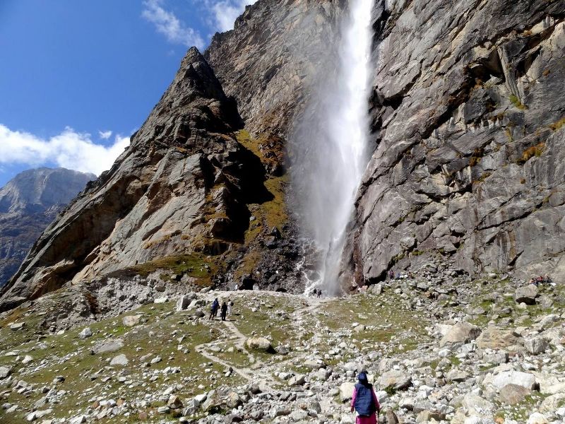
The Satopanth Taal Trek will be a life-changing experience for you. You will visit the places which have great value in our traditional history; you will witness Vasundhara, a 400-feet waterfall, the beautiful birch forests of Laxmiban and the view of Balakun, where two massive glaciers converge.
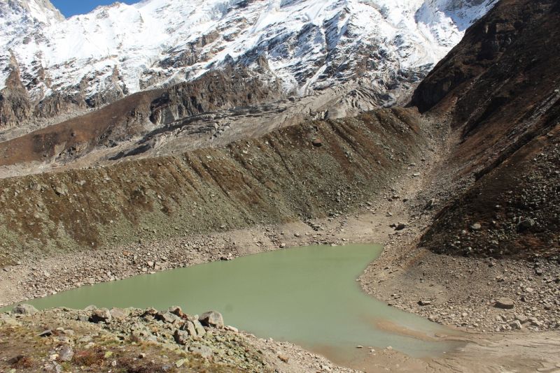
Close to the hustle-bustle of the holy town of Badrinath lies a secluded, untouched glacial lake called Satopanth. It’s located near the base of the 7138 m Chaukhamba massif. The trek to Satopanth Lake starts from Mana – the last village near the Indo-China border in Uttarakhand. From Mana, you follow the Alaknanda River to its snout at Alkapuri and walk next to the glacier to reach the undulating meadows Laxmiban and Chakrateerth before reaching the lake. The maximum altitude you gain during Satopanth lake trek is 15,100 ft. With its crystal clear green water, the triangular lake has a perimeter of one kilometer. On its three corners meditated the holy trio – Brahma, Vishnu, and Mahesh and still do, it is believed – the creator, the preserver and the destroyer charting out the course of the world.
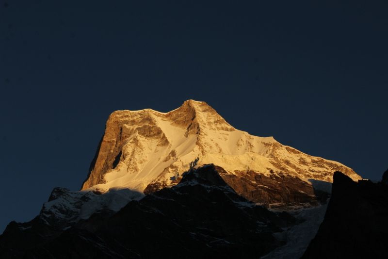
Satopanth Taal Lake Trek is nestled on the base of legendary Neelkantha peak and several other prominent peaks in proximity. The route offers splendid views of Chaukhamba, Neelkantha, Balakun, Kamet and Abi Gamin. Hidden amidst the most impressive ranges of the Garhwal region, this bright green lake exudes grace and serenity. The best time to do Satopanth Lake Trek is May – June, and September – October.
Note: Only experienced (at least 2 moderate level treks) trekkers should try this trek.
Satopanth Lake has a very rich history. It is considered to be a religious place for the locals. It is believed that the trimurthis(triple deity of the divinity in Hinduism), Brahma, Vishnu, Maheswara meditated on its three corners.
Some articles say that at the end of the Mahabharata, Pandavas took the route from Mana village to reach the steps to heaven which is on the Swargarohini glacier via Satopanth Tal.
Once you reach Chakrateertha campsite, make sure you cover your head and wear a fleece jacket. do not expose yourself too much to the cold. The temperature here can be 5 to 10 degree day time and -5 to 0 degree during night.
Check the oximeter reading. If the reading is below 90 or you are showing any symptoms of headache, nausea, fatigue, loss of appetite or dizziness, you need to descend down immediately. These are signs of Altitude sickness. It can lead to deadlier conditions if not recognized on time.
Drive distance: 327 Kms || Time taken: 10-11 hrs
To travel from Dehradun to Badrinath, it usually takes 10-11 hours by car. But depending on road condition, it may go 1 hour more. The distance required to cover is 327 kms.
The altitude gain is near about 10,000 ft. The road trip comes with amazing views of the surroundings. You can get to Joshimath from Haridwar or Rishikesh by bus or by reserved car. The drive is very scenic and runs along the Ganga and its tributaries. Breakfast and lunch on the way. Check-in hotel & rest for the day.
Since the trek starts at a high altitude of 10,830 ft, a buffer day is a must. Today, you can go to Mana village, explore a bit there and come back to Badrinath.
Since the Inner Line Permit(ILP) is compulsory, you can also get it done from Joshimath if you do not have it.
Rest well on that night and prepare yourself for a long trek ahead.
Trek Distance: 9-10 kms || Trek Duration: 5–6 hrs
Start the trek early in the morning from Badrinath. The trek distance to be covered is about 10 km. You walk on the Badrinath to Mana road all the way to the Mana village
After a 3 km trek in the same trail, on your right side, you can see the Mana village. This is India’s last village to the China border. Mana is just 26 km away from the India China border. You can also see the road that goes to the border. But the entry is restricted only to people in the army.
From this village, the trail deviates towards the left side (towards Eastern side) of the Alaknanda River. There is a proper man-made trail from here for a few kilometres. After 2 to 3 km from the village, you start to hear the sound of water plunging down from almost 400 ft. Soon, you see the graceful Vasundhara fall on your right.
There is another route to reach Vasundhara falls from Mana village. It is from the right side of the Alaknanda river. Tourists and villagers visit the waterfall and return back to the village from that side.
It is proven that the water of Vasundhara falls as well as the Alaknanda river holds medicinal value. Hence, many people carry the water in a bottle and store it.
Take a quick break here. Drink some water. Since you are gaining altitude as you are covering the distance, you need to keep yourself hydrated throughout the trek. Make sure you fill your water bottle here.
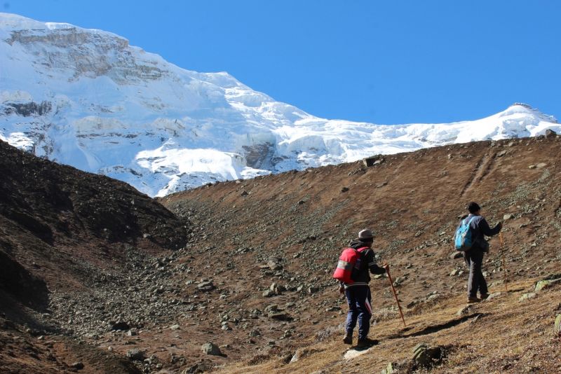
As you cross the falls and continue towards Lakshmi van campsite, the valley opens up into two. Stay on the left bank throughout the trek. After 3 km of moraine walk on the left bank of the Alaknanda river, you reach the Lakshmi van campsite. Now you are at an altitude of 11,900 ft. Take the oximeter reading. It should be above 90. If it is below 90, start descending down immediately.
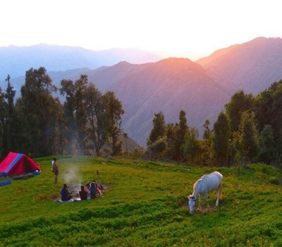
This campsite is on the green grassland. You find a lot of Bhoj-Patra trees in this campsite.
Trek Distance: 7-8 kms || Trek Duration: 4-5 hrs
Today’s trek is slightly difficult as the altitude gain is more than 2000 ft. But, it is a scenic route as you enter Satopanth valley. Before starting the trek, make sure you have a healthy breakfast and pack some snacks to eat on the way. Keep drinking water the entire day.
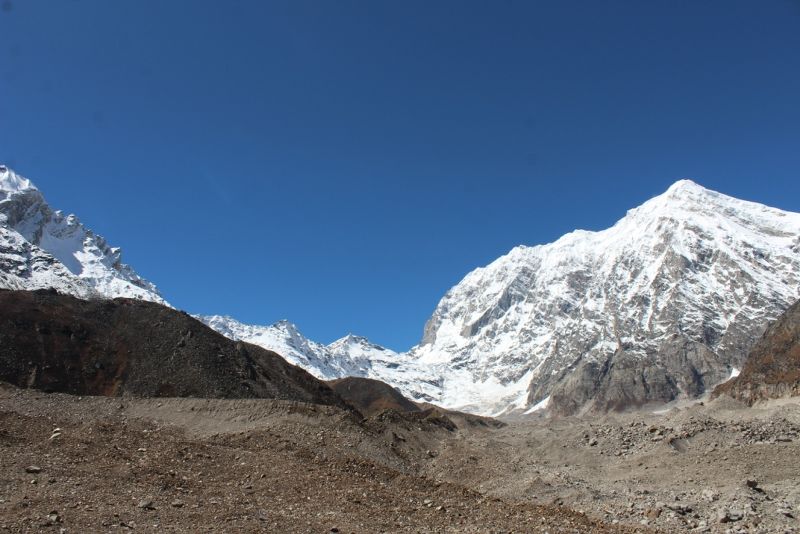
The trail continues to be on the bank of the Alaknanda river. You trek on the grassland in the middle of the terminal moraine of Dhano glacier.
Keep your eyes open for some of the most beautiful alpine flowers on the trail. Once you cross this patch you start to see the 3 peaks of Bhagirathi in front of you (Only if the weather is clear).
After around 5 km of a trek, you reach the Sahastradhara. From here you can see Mount Neelkanth on the left side.
You also spot more than 100 of small waterfalls on the huge monolithic rock in front of the mountain.
The weather here changes drastically post noon. You are at an altitude of 14,000 ft. At higher altitude weather becomes unpredictable post noon. Make sure you reach the campsite as early as possible.
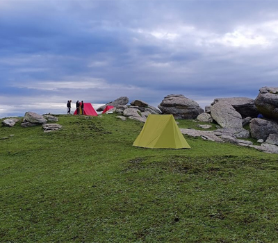
From here Chakrateertha campsite is around half an hour. It is a flat grassland where we can pitch our tent for the night.
Trek Distance: 10-12 kms (6+6) || Trek Duration: 8-10 hrs
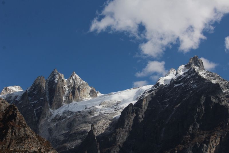
Prepare yourself for a jaw-dropping view today early in the morning. With Mount Neelkanth on your left, Chaukanmba at the centre, Balakun range on your right, you can not forget this sight soon. Keeping the view in mind, get ready for a difficult day of the trek.
The initial trail from Chakrateertha is pretty flat and you trek on the grassland.
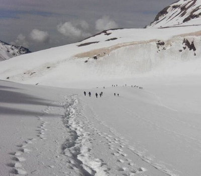
After 2 km of the trek, the trail mazes through boulders and moraine. You need to trek very carefully. Take the help of a trekking pole here.
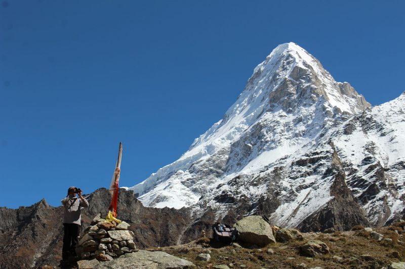
Satopanth Tal is still hidden. You get the first view of the Taal only when you reach the top of the ridge. From there you can see the triangular Satopanth Lake. The lake looks very small in the picture but when you stand in front of it, it is huge. It has a perimeter of over 1 km.
There is a small room constructed as a temporary shelter here using stones. A Local sage Mauni Baba is known to live near the lake.
The views from here are spectacular. Spot the Mount Chaukhamba at the centre, Balakun on the right, Swargarohini towards left and Neelkanth standing behind you towards left.
The water quality of the Lake is excellent. It stays clean throughout the year. There are stories and beliefs that few rare birds keep the lake clean all the time. But nobody has spotted those birds till now. You might be that rare person who spots on the trek!
There is also one more interesting thing to see from here. If the weather is clear, you can also see the 3 steps out of 7 on the Swargarohini glacier which is believed to be the steps to heaven that Pandavas took.
Enjoy the calmness around the lake for maximum an hour. This is the perfect setting to reflect on your long journey. After having packed lunch or snacks, start the return journey to Chakrateertha. It will take around 3 to 4 hours to reach back to the campsite.
Trek Distance: 15-16 kms || Trek Duration: 6-8 hrs
Take the same trail taken to reach Chakrateertha from Lakshmi van and again from mana to Lakshmi van. This will take around 6 to 8 hours to reach Mana village.
If you are too tired to walk up to Badrinath, we can arrange a jeep or taxi from Mana village to bring you to Badrinath.
Check-in hotel & rest for the night.
Today, we will say our goodbyes and will drive back to Dehradun. You should not book your return flight tickets on this day. Get in touch with Himalayan Memories team for a suggestion or support.
+91 7604030342 / 7604030349
hmdesk@himalayanmemories.com
