08 Nights / 09 Days
Hard Trek
14,816 ft
May to June & Sept to Oct
Uttarakhand
Joshimath
The twin peaks of Nanda devi and Nanda Devi East (7434 m) exude an aura unsurpassed by any mountain in the Indian Himalayas. Lying entirely within Indian borders Nanda Devi is just short of being an 8 thousander. Climbed first in 1937 by legendary climber and explorer Major Harold William Bill Tillman better known as H.W Tilman and famed Noel Odell, (Noel was the last first person to see Mallory and Irvine supposedly climbing the Second step on Mount Everest on 8th June 1924) its tryst with exploration goes back to 1930s when a number to expeditions repeatedly failed to reach even its base. The reason for this lying in the fact that the main summit is surrounded by an impenetrable barrier of peaks. The average height of this barrier being 20000 ft, the tag impenetrable is just right.
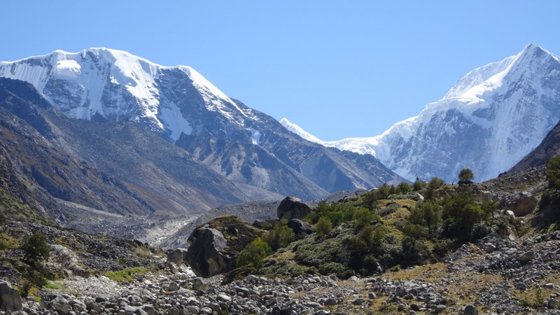
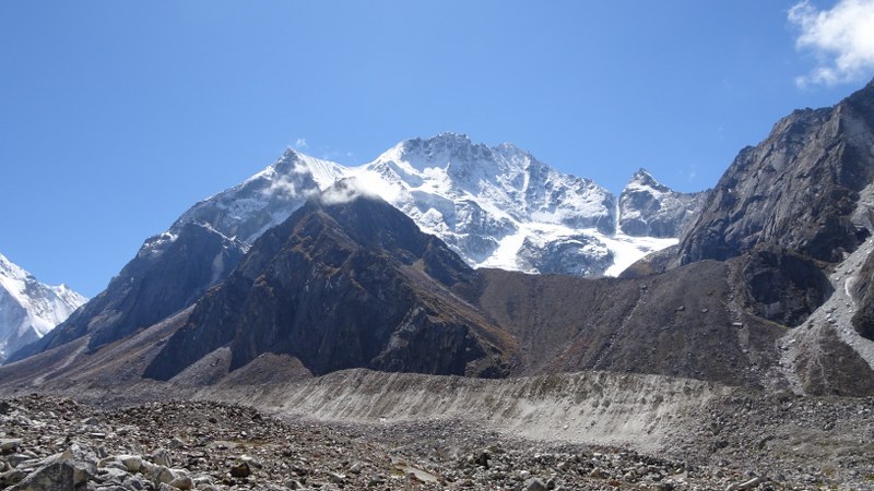
The Nanda Devi National Park is a national park situated around the peak of Nanda Devi. The park encompasses the Nanda Devi Sanctuary, a glacial basin surrounded by a ring of peaks between 6000 m and 7500 m high, and drained by the Rishi Ganga, through the Rishi Ganga Gorge, a steep, almost impassable defile. The entire park lies at an elevation of more than 3500 m above mean sea level. Some of the peaks in this sanctuary are Dunagiri, Kalanka, Changabang, Rishi Pahar, Nanda Khat, Nanda Ghunti, Panwali Dwar, Trishul etc. After many failed expeditions and arduous explorations in 1934, British explorers Eric Shipton and Tillman found a route inside the sanctuary through the Rishi Gorge. Nanda devi main (7786 m) is surrounded by a thick wall of peaks, there is an inner wall as well as an outer wall. Bagini glacier lies to the North of this outer wall.
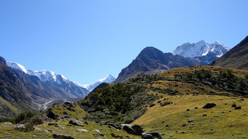
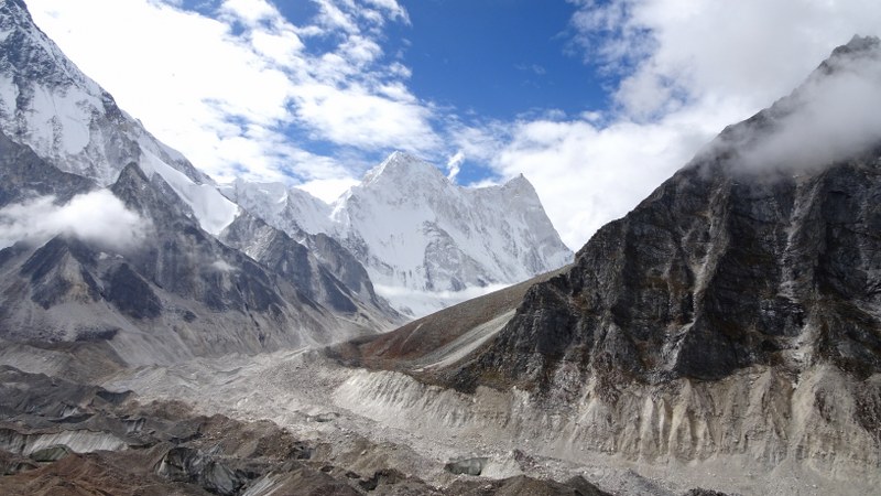
Bagini Glacier is situated to the north of the outer wall of Nanda Devi Peak. It is a moderate trek, with the trail passing through some interesting Garhwali villages, flower-strewn meadows and lush forests. The view of several Himalayan peaks like Hathi Parvat, Ghodi Parvat, Rishi Peak, Satminal, Hardeul, Kalanka, Trishuli and Dunagiri East also makes this trekking expedition in Uttarakhand quite exciting.
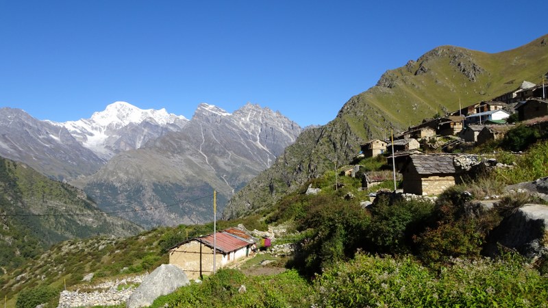
Bagini Glacier trek is such a route which takes you to the Advance camp taken for mountaineering expeditions to high ranging peaks like Changbang and Kalanka. It gives you a feel of being in Everest Base Camp without its hustle and bustle of overcrowding and commercialization. It takes about 5 to 6 days to accomplish Bagini Glacier trek that originates from Jumma (44kms from Joshimath) and then following the trail to Ruing Village, Dronagiri Village and Bagini Village it reaches Bagini and Changbang Base Camp.
Best time to visit Bagini Glacier
The best seasons to do trekking on Bagini Glacier are summer and autumn. From early May to mid-June and from late September to mid-October are the suitable months. The region is surrounded by beautiful snow-capped peaks during this time and the climate is moderate. Monsoon season should ideally be avoided for any trek.
Weather and Temperature
In summer and autumn, the weather at Bagini Glacier is soothing and moderately cold. From April to June, the temperature is between 15 and 20 degrees Celsius during the day and at night it comes to the lowest of -2 degree Celsius. From September to October, the temperature stays between 15 to 10 degrees Celsius during the day and at night it varies from 5 to -5 degrees Celsius. The weather is relatively colder after monsoons. Snowfalls occur during winters.
How Difficult is Bagini Glacier trek
The level of difficulty of the Bagini Glacier Trek ranges between moderate to difficult. The route of the trek has narrow trails with rocks and boulders, which makes it slightly difficult for beginners. Concentration is very much needed as the rough trails can be dangerous. The maximum altitude of the trek is 14,816 feet. Regular exercising and eating healthy will ensure that the trekking does not cause over-exhaustion.
Drive Distance: 290 Kms || Time taken: 10-11 hrs
To travel from Dehradun to Joshimath, it usually takes 10-11 hours by car. The distance required to cover is 290 kms. The road trip comes with amazing views of the surroundings. There are shops on the way, so water will be easily available. There are various places that come along the way, such as Laxman Jhula, Dev Prayag, Rudra Prayag, etc. Beautiful valleys, sparkling rivers, and hills surround the meandering roads. The journey is nothing less than a visual retreat. Breakfast and lunch on the way. Check-in hotel & rest for the day.
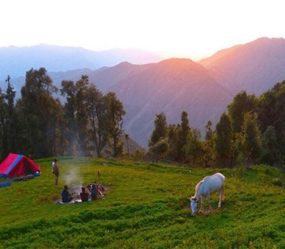
The trek starts from Jumma which is an hour ride from Joshimath. It takes an hour to cover 45 km and reach Jumma from Joshimath via Auli road. We then trek for 3km to reach Ruing village and gain an altitude of 810 ft. Generally, you should be reaching within 3-4 hours of time. Water is to be carried. The roads are partly uneven. Many villages fall on the route. In between Suraithota village and Jumma, the road is on par with the Dhauliganga river. The afternoons are showered with a cool breeze as Jumma is near the Tibetan border.
The trail begins with a steel suspension bridge over the Dhauliganga, marking the ascent of Ruing. The road to Ruing is slightly steep through the forest. It takes around 2-3 hours to cover the distance. Staying at the Panchayat Ghar is advisable. If not, we hike further 2-3 km from Ruing and arrive at a small grassland before the ascent of Dronagiri.
Staying here reduces the distance to Dronagiri and saves time for the next day. There is also a natural stream nearby which offers a beautiful view.
Trek Distance: 8-9 Kms || Time taken: 5 to 6 hrs
It takes 5-6 hours of trek to cover 8 km and reach Dronagiri. The altitude gain is 2657 ft. The trail is similar to that of Jumma to Ruing. Water is available at the campsite. We leave Ruing and start trekking through the meandering roads of the forests, with little or no sideways. At a distance of about 3.5 meters from the Campsite, the landslide zone begins. There are two visible trails here. The upper trail is a remnant of an old trail that linked it to the village previously, so we won’t be taking this trail.
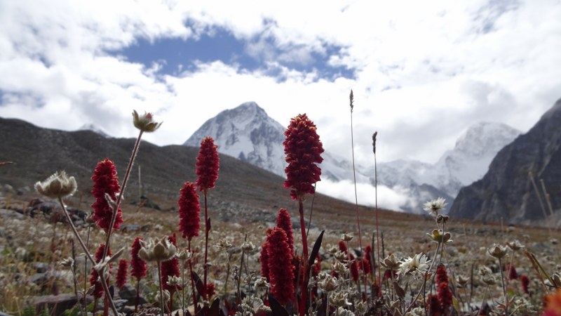
The downward trail is full of dust and sharply inclined at an angle of 60° to 70º to the horizontal. Mudslides and pristine clean streams accompany you all the way to the top. A well-constructed sidewalk leads to the village, once you reach. The view from this place is spectacular as the Hathi and Ghori Parbat peaks are covered with snow. The valleys are adorned with vibrant flowers during summers. We camp on the outskirts of the Dronagiri village. You can also visit the Bhumial Temple nearby.
Trek Distance: 3 Kms || Time taken: 4-5 hrs
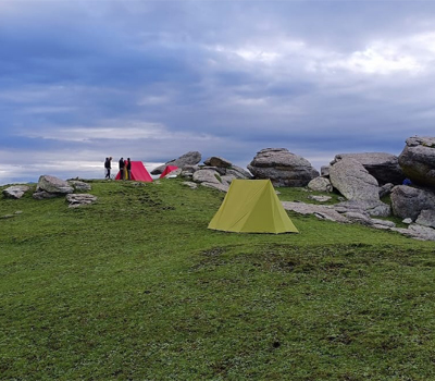
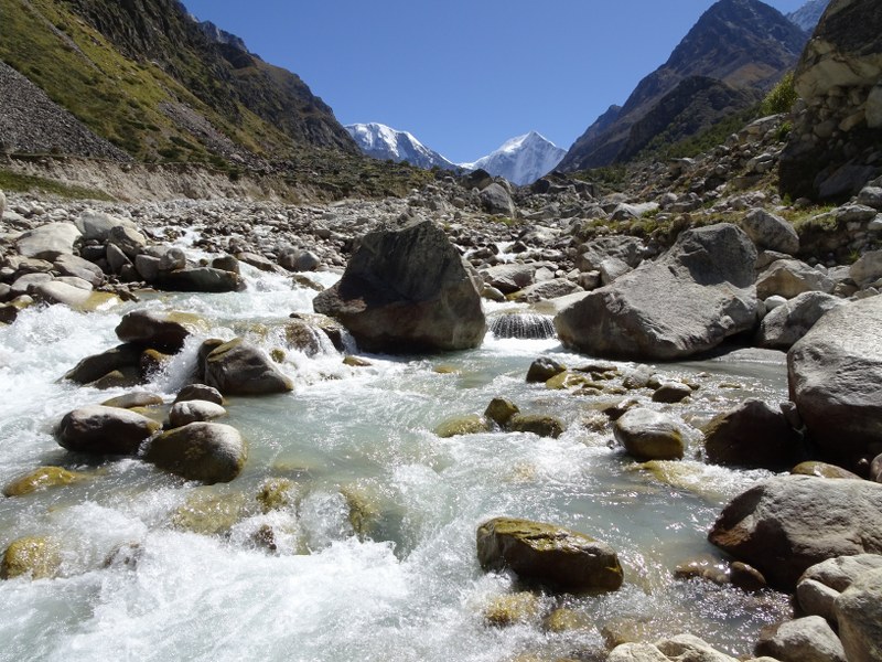
It takes 4-5 hours of trek to cover 3 kms and reach Loungatulli. The altitude gain is 620 ft, and the route lacks greenery. Drinking water is easily available as Bagini Glacier is nearby. We leave Dronagiri and arrive at a winding path which leads us to a high ridge from where the Rishi peak and Bagini Nala are first visible. The bridge of Bagini Nala comes after thirty minutes of leaving the village.
The trail after the bridge takes a meandering turn upwards. The path is filled with boulders and rocks, and no sight of vegetation. We reach a stream surrounded with patches of greenery after 1.15 hours. Continue an hour more and reach the campsite of Longatulli. We camp for the night.
Trek Distance: 5-6 Kms || Time taken: 4 to 5 hours
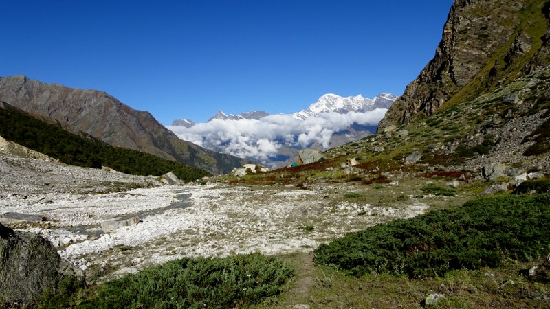
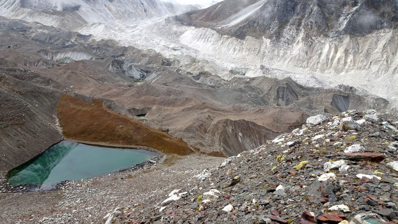
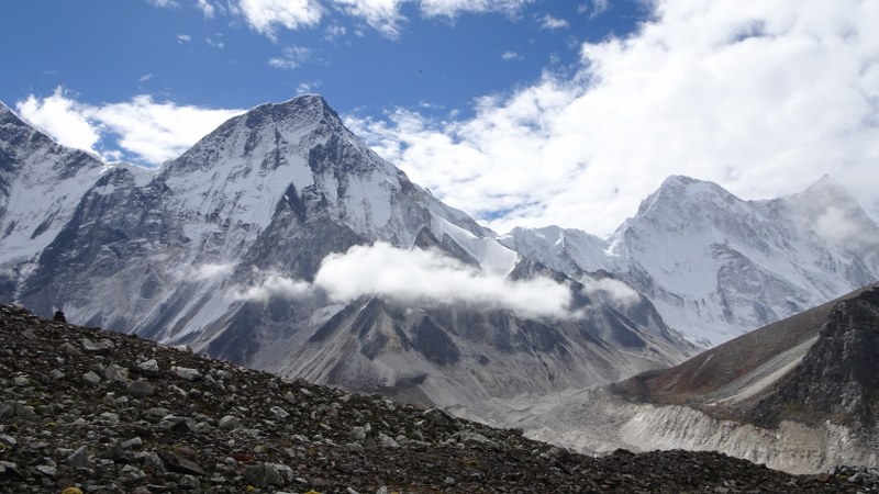
The distance from Loungatulli to Base camp is 5-6 km and it is 4-5 hours of trek, and the altitude gain is 2244 ft. It takes 45 minutes more to reach the Advanced Bagini Campsite, which has a relatively better view. Water is available at the campsite, but there are no shops on the way. After breakfast, we will start our trek for Base Camp. We reach the Bagini lower base camp after a proper 3 hours hike on a rough track from Longatulli. The campsite is a plain plateau. The splendid views of Satminal, Hardeul, and Rishi Pahar is bound to leave you astonished at this point. The Bagini main base camp is further up the mountains. We can either camp here or in a better place which is 45 minutes away.
The Advanced Bagini Base Camp offers beautiful views of the peaks and is ideal for camping. The route is not properly marked.
One needs to concentrate and focus on the road to follow the trail accurately. Few signs like a group of small stones arranged on top of one another are made for the convenience of fellow trekkers to help them navigate better.
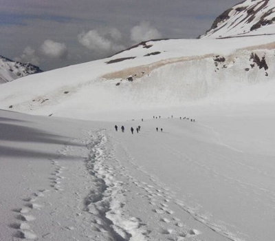
Trek Distance: 10-12 Kms || Time taken: 10-12 hours
Today is the ‘D’ day of the trek and it is also the toughest and the longest day where the trekkers reach the summit point. The total distance to be covered is 10 -12 km and the altitude gain is 103 ft. The route gets difficult as we proceed towards the glacier. We return to the Base camp. Water is available at the campsite, as well as on the way. We leave early to experience the sunrise from Changabang base camp. The distance between the two base camps is around 3-4 km. The route from the Advanced base camp to the Changabang base camp is an upward trail.
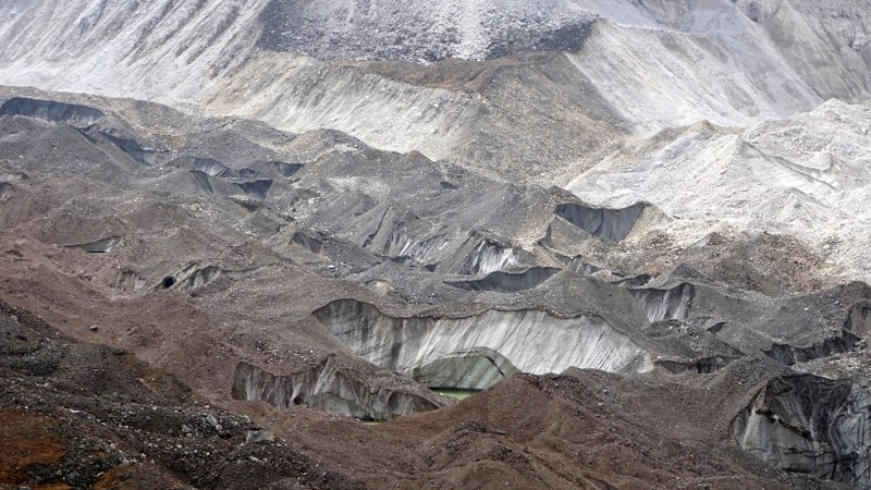
The road is full of glacial deposits, and crevasses can be spot on the Bagini Glacier.
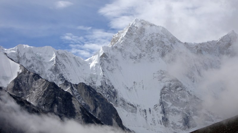
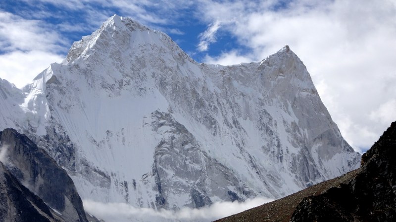
Changabang Base Camp offers breathtaking views of the Hathi (6507m), Dunagiri east (7066m), Trishuli (7057m), Rishi(6099m), Kalanka(6931m), Changabang (7174m) peaks and many others.
Trek Distance: 18 Kms || Time taken: 10-12 hrs
The distance from the Base camp to Ruing is 18 km, and it is a trek of 10-12 hours. We follow the same route that we took to reach the Base camp. Descend for around 18 km via Longatulli to arrive at Dronagiri and later at Ruing village. We camp here for the night.
Trek Distance: 3 Kms || Time Taken: 3 hrs
We start in the morning, take a descent of 3 hours to reach Jumma, and then drive to Joshimath. Overnight stay in a guest house or hotel. To cover 3 km from Ruing to Jumma, it takes 3 hours of trek. We drive 45 km more to reach Joshimath. The drive is for an hour.
After breakfast, checkout from hotel & get transferred to Dehradun.
Today, we will say our goodbyes and will drive back to Dehradun. You should not book your return flight tickets on this day. Get in touch with Himalayan Memories team for a suggestion or support.
+91 7604030342 / 7604030349
hmdesk@himalayanmemories.com
